What If? (33 page)
Authors: Randall Munroe

Th
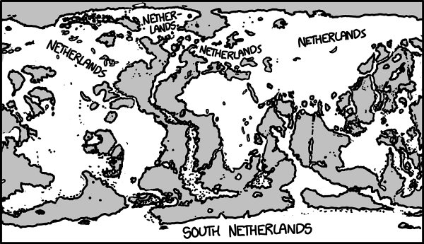
is is what the map looks like when the drain finally empties.
Th
ere’s a surprising amount of water left, although much of it consists of very shallow seas, with a few trenches where the water is as deep as 4 or 5 kilometers.
Vacuuming up half the oceans would massively alter the climate and ecosystems in ways that are hard to predict. At the very least, it would almost certainly
involve a collapse of the biosphere and mass extinctions at every level.
But it’s possible
—
if unlikely
—
that humans could manage to survive. If we did, we’d have this to look forward to:
- 1
Remember to clean the whale filter every few days.
Drain the Oceans: Part II
Q.
Supposing you
did
drain the oceans, and dumped the water on top of the
Curiosity
rover, how would Mars change as the water accumulated?
—Iain
A.
In the previous answer,
we opened a portal at the bottom of the Mariana Trench and let the oceans drain out.
We didn’t worry too much about where the oceans were draining
to
. I picked Mars; the
Curiosity
rover is working so hard to find evidence of water, so I figured we could make things easier for it.
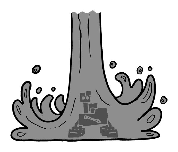
Curiosity
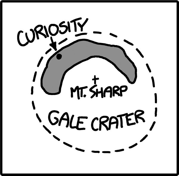
is sitting in Gale Crater, a round depression in the Martian surface with a peak, nicknamed Mount Sharp, in the center.
Th
ere’s a lot of water on Mars.
Th
e problem is, it’s frozen. Liquid water doesn’t last long there, because it’s too cold and there’s too little air.
If you set out a cup of warm water on Mars, it’ll try to boil, freeze, and sublimate, practically
all at once. Water on Mars seems to want to be in
any
state except liquid.
However, we’re dumping a lot of water very fast (all of it at a few degrees above 0°C), and it won’t have much time to freeze, boil, or sublimate. If our portal is big enough, the water will start to turn Gale Crater into a lake, just like it would on Earth. We can use the excellent USGS Mars Topographic Map to chart
the water’s progress.
Here’s Gale Crater at the start of our experiment:
As the flow continues, the lake fills in, burying
Curiosity
under hundreds of meters of water:
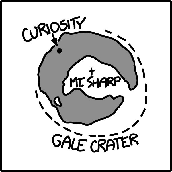
Eventually, Mount Sharp becomes an island. However, before the peak can disappear completely, the water spills over the north rim of the crater and starts flowing out across the sand.
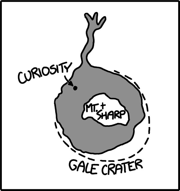
Th
ere’s evidence that
—
due to occasional heat waves
—
ice in the Martian soil occasionally melts and flows as a liquid. When this happens, the trickle of water quickly dries up before it can get very far. However, we’ve got a lot of ocean at our disposal.

Th
e water pools in the North Polar Basin:
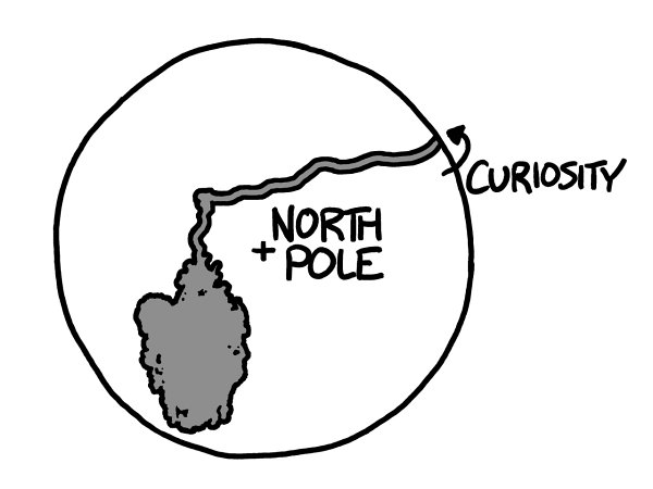
Gradually, it will fill the basin:
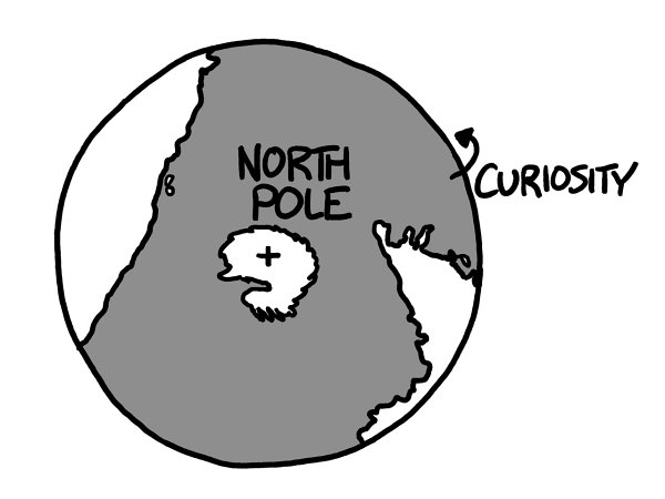
However, if we look at a map of the more equatorial regions of Mars, where the volcanoes are, we’ll see that there’s still a lot of land far from the water:

[Mercator projection; does not show the poles.]
Frankly, I think this map is kind of boring; there’s not a lot going on. It’s just a big empty swath of land with some ocean at the top.

Would not buy again.
We haven’t come close to running out of ocean yet although there was a lot of blue on the map of the Earth at the end of our last answer, the seas that remained were shallow; most of the volume of the oceans was gone.
And Mars is much smaller than Earth, so the same volume of water will make a deeper sea.
At this point, the water fills in the Valles
Marineris, creating some unusual coastlines.
Th
e map is less boring, but the terrain around the great canyons makes for some odd shapes.
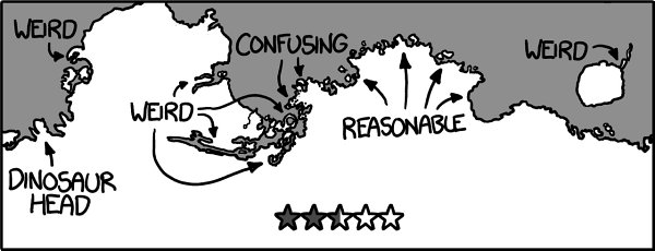
Th
e water now reaches and swallows up Spirit and Opportunity. Eventually, it breaks into the Hellas Impact Crater, the basin containing the lowest point on Mars.
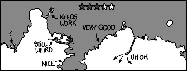
In my opinion, the rest of the map is starting to look pretty good.
